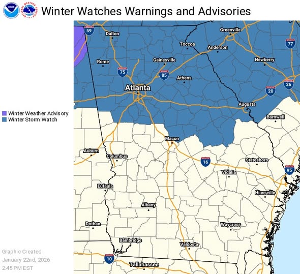
A major winter storm is still expected to bring significant impacts to North Georgia, including Metro Atlanta, this weekend. The Winter Storm Watch has been expanded southward to include all counties north of I-20, the entire Metro Atlanta area, and several counties north and east of Macon.
One-quarter to three-quarters of an inch of ice accumulation is possible in the Watch counties between Saturday afternoon and Sunday night. Temperatures will drop below freezing Sunday evening and will remain very cold through Tuesday. Any moisture remaining on roads before late Sunday night will refreeze in addition to any lingering ice accumulations.
If you are in the Watch area, plan to stay off the roads due to hazardous conditions as early as Saturday afternoon. Downed trees and power lines could cause extended power outages and debris issues. Extreme cold temperatures Monday night into Tuesday morning could also cause burst pipes. These impacts could continue into Monday afternoon.
GEMA/HS is closely monitoring the forecast and coordinating with federal, state, and local partners to ensure Georgians have the resources and information they need before, during and after potential winter weather impacts.
We encourage residents to stay informed and have a plan in place to protect themselves and their families. For ongoing updates, follow GEMA/HS, the National Weather Service, your local emergency management agency and trusted media outlets. For preparedness tips, visit https://gema.georgia.gov/winter.